
Dansenberg topographic map
Interactive map
Click on the map to display elevation.
About this map
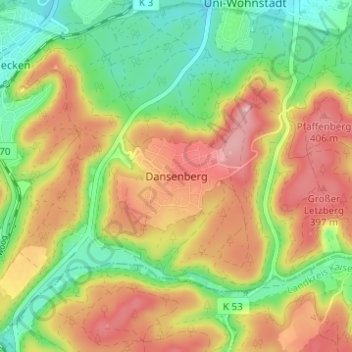
Name: Dansenberg topographic map, elevation, terrain.
Location: Dansenberg, Kaiserslautern, Rijnland-Palts, 67661, Duitsland (49.38498 7.70837 49.42498 7.74837)
Average elevation: 1,102 ft
Minimum elevation: 853 ft
Maximum elevation: 1,371 ft