
Fraigata topographic map
Interactive map
Click on the map to display elevation.
About this map
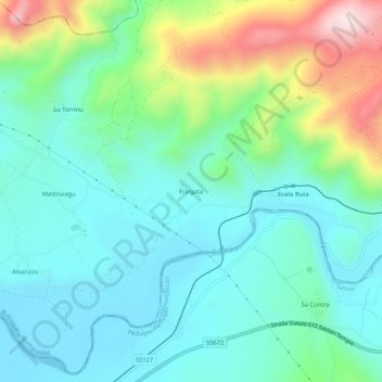
Name: Fraigata topographic map, elevation, terrain.
Location: Fraigata, Bortigiadas, Nord-Est Sardegna, Sardegna, Italia (40.84869 8.92195 40.88869 8.96195)
Average elevation: 482 ft
Minimum elevation: 69 ft
Maximum elevation: 1,677 ft