
Tapana topographic map
Interactive map
Click on the map to display elevation.
About this map
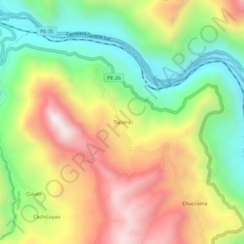
Name: Tapana topographic map, elevation, terrain.
Location: Tapana, Huando, Huancavelica, Peru (-12.54095 -74.98933 -12.50095 -74.94933)
Average elevation: 10,755 ft
Minimum elevation: 9,318 ft
Maximum elevation: 12,487 ft