
Makepe topographic map
Interactive map
Click on the map to display elevation.
About this map
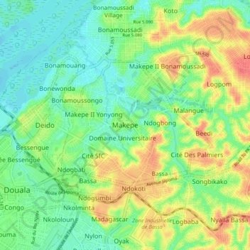
Name: Makepe topographic map, elevation, terrain.
Location: Makepe, Douala V, Communauté urbaine de Douala, Wouri, Cameroun (4.02381 9.70096 4.10381 9.78096)
Average elevation: 69 ft
Minimum elevation: -7 ft
Maximum elevation: 171 ft