
Sweileh topographic map
Interactive map
Click on the map to display elevation.
About this map
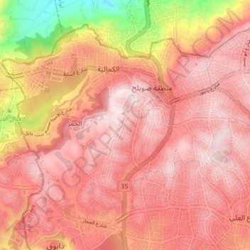
Name: Sweileh topographic map, elevation, terrain.
Average elevation: 3,196 ft
Minimum elevation: 2,221 ft
Maximum elevation: 3,606 ft
Other topographic maps
Click on a map to view its topography, its elevation and its terrain.
Dabouq
Jordan > Amman > Al-Jami'ah Sub-District
Dabouq, Al-Jami'ah Sub-District, Al-Jami'ah District, Amman, 11831, Jordan
Average elevation: 3,091 ft