
Giresun topographic map
Interactive map
Click on the map to display elevation.
About this map
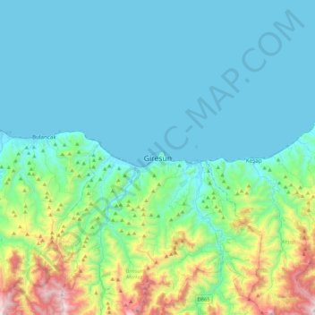
Name: Giresun topographic map, elevation, terrain.
Average elevation: 853 ft
Minimum elevation: 0 ft
Maximum elevation: 4,872 ft
Other topographic maps
Click on a map to view its topography, its elevation and its terrain.
Kapu Mahallesi
Kapu Mahallesi, Giresun, Région de la mer Noire, Turquie
Average elevation: 138 ft