
Thank you for supporting this site ❤️
Make a donation
Make a donation
Gear up for your next adventure:
As an Amazon Associate, this site earns from qualifying purchases at no extra cost to you.
Concepción topographic map
Click on the map to display elevation.
Thank you for supporting this site ❤️
Make a donation
Make a donation
Gear up for your next adventure:
As an Amazon Associate, this site earns from qualifying purchases at no extra cost to you.
About this map
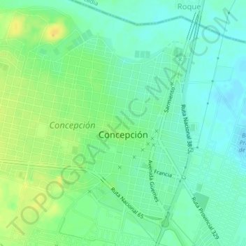
Name: Concepción topographic map, elevation, terrain.
Average elevation: 1,224 ft
Minimum elevation: 1,184 ft
Maximum elevation: 1,273 ft
Thank you for supporting this site ❤️
Make a donation
Make a donation
Gear up for your next adventure:
As an Amazon Associate, this site earns from qualifying purchases at no extra cost to you.
Other topographic maps
Click on a map to view its topography, its elevation and its terrain.
Yerba Buena
Yerba Buena is the capital of the Yerba Buena Department in the province of Tucumán, Argentina. It is located at an altitude of around 466 metres (1528 feet).
Average elevation: 1,939 ft