
Rinella topographic map
Interactive map
Click on the map to display elevation.
About this map
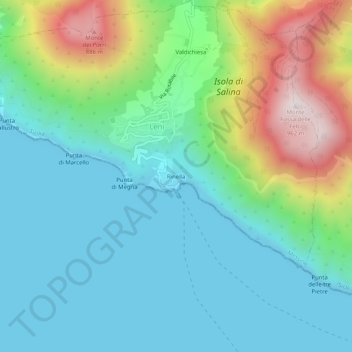
Name: Rinella topographic map, elevation, terrain.
Location: Rinella, Leni, Messine, Sicile, 98050, Italie (38.52879 14.80829 38.56879 14.84829)
Average elevation: 804 ft
Minimum elevation: 0 ft
Maximum elevation: 3,087 ft
Other topographic maps
Click on a map to view its topography, its elevation and its terrain.
Isola di Salina
Italie > Sicile > Messine > Leni
Isola di Salina, Leni, Messine, Sicile, 98050, Italie
Average elevation: 571 ft