Geolocate

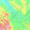
Buchères topographic map

Click on the map to display elevation.

About this map

Name: Buchères topographic map, elevation, terrain.

Location: Buchères, Troyes, Aube, Grand Est, Metropolitan France, 10800, France (48.22061 4.08609 48.25248 4.14144)

Average elevation: 394 ft

Minimum elevation: 358 ft

Maximum elevation: 446 ft

Other topographic maps

Click on a map to view its topography, its elevation and its terrain.

Les Mazots

France > Grand Est > Aube > Villenauxe-la-Grande

Average elevation: 535 ft

Val de Mont

France > Grand Est > Aube > Meurville

Average elevation: 833 ft

Troyes

France > Grand Est > Aube > Troyes

Average elevation: 495 ft

Clairvaux

France > Grand Est > Aube > Ville-sous-la-Ferté

Average elevation: 781 ft

Vaugan

France > Grand Est > Aube > Dosnon

Average elevation: 436 ft

Margale

France > Grand Est > Aube > Fuligny

Average elevation: 682 ft

Le Pré Bable

France > Grand Est > Aube > Marolles-sous-Lignières

Average elevation: 541 ft

Gear up for your next adventure:

📱Solar Portable Charger - Solar power bank for charging devices off‑grid
🔭Stargazing Telescopes - Perfect for camping in low-light pollution areas shown on maps
🔌USB Car Charger - Car charger for on‑the‑go power needs
🛡️Bear Spray Outdoor - Protection in bear country hikes
👟Men's Trail Runners - Lightweight footwear for fast-paced exploration and light hiking

As an Amazon Associate, this site earns from qualifying purchases at no extra cost to you.