
Make a donation
Gear up for your next adventure:
As an Amazon Associate, this site earns from qualifying purchases at no extra cost to you.
Mount Lamlam topographic map
Click on the map to display elevation.
Make a donation
Gear up for your next adventure:
As an Amazon Associate, this site earns from qualifying purchases at no extra cost to you.
Mount Lamlam
Rising to 406 meters (1,332 ft) above sea level, the distance from the peak to the bottom of the nearby Mariana Trench is said to be the greatest change in elevation on Earth over such a short distance.
Make a donation
Gear up for your next adventure:
As an Amazon Associate, this site earns from qualifying purchases at no extra cost to you.
About this map
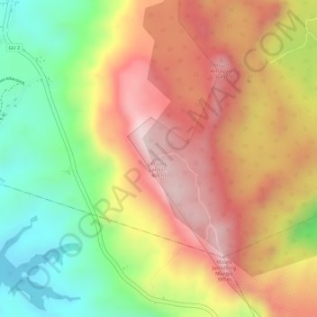
Name: Mount Lamlam topographic map, elevation, terrain.
Location: Mount Lamlam, Hågat Municipality, Guam, 96916, United States (13.33781 144.66668 13.33791 144.66678)
Average elevation: 732 ft
Minimum elevation: 33 ft
Maximum elevation: 1,296 ft
Guam trails, hiking, mountain biking, running and outdoor activities
Make a donation
Gear up for your next adventure:
As an Amazon Associate, this site earns from qualifying purchases at no extra cost to you.