Geolocate

Laurel topographic map

Click on the map to display elevation.

About this map

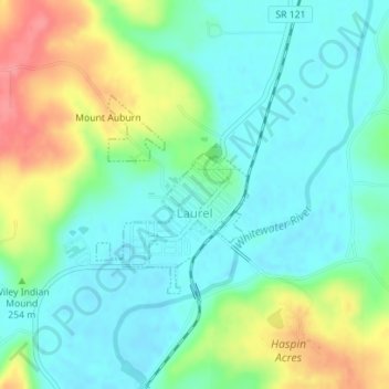
Name: Laurel topographic map, elevation, terrain.

Location: Laurel, Franklin County, Indiana, United States (39.49532 -85.19520 39.50909 -85.18147)

Average elevation: 787 ft

Minimum elevation: 702 ft

Maximum elevation: 978 ft

Franklin County trails, hiking, mountain biking, running and outdoor activities

Other topographic maps

Click on a map to view its topography, its elevation and its terrain.

Metamora

United States > Indiana > Franklin County

Average elevation: 794 ft

Metamora

United States > Indiana > Franklin County

Average elevation: 794 ft

Gear up for your next adventure:

🚗GPS Dash Cams - Record your scenic drives through mountain passes and canyons
🔭Stargazing Telescopes - Perfect for camping in low-light pollution areas shown on maps
🏥Hiking First Aid Kits - Comprehensive medical kits for remote trail injuries
🛰️Handheld GPS Units - Professional satellite navigators for precise backcountry mapping
📖Nature Tracking Books - Learn to track wildlife and terrain

As an Amazon Associate, this site earns from qualifying purchases at no extra cost to you.