
Unpongor topographic map
Interactive map
Click on the map to display elevation.
About this map
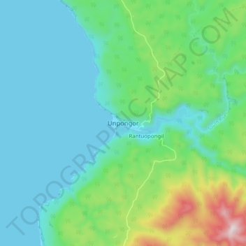
Name: Unpongor topographic map, elevation, terrain.
Location: Unpongor, Tafea, Vanuatu (-18.85800 168.97825 -18.77800 169.05825)
Average elevation: 535 ft
Minimum elevation: 0 ft
Maximum elevation: 2,448 ft
Other topographic maps
Click on a map to view its topography, its elevation and its terrain.
TAFEA Provincial Disaster Committee
TAFEA Provincial Disaster Committee, Nakepau, Lénakel, Tafea, Vanuatu
Average elevation: 240 ft