
Thank you for supporting this site ❤️
Make a donation
Make a donation
Gear up for your next adventure:
As an Amazon Associate, this site earns from qualifying purchases at no extra cost to you.
Gestratz topographic map
Click on the map to display elevation.
Thank you for supporting this site ❤️
Make a donation
Make a donation
Gear up for your next adventure:
As an Amazon Associate, this site earns from qualifying purchases at no extra cost to you.
About this map
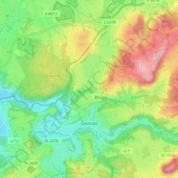
Name: Gestratz topographic map, elevation, terrain.
Location: Gestratz, Argental (VGem), Landkreis Lindau, Bavaria, Germany (47.63160 9.96334 47.68497 10.03116)
Average elevation: 2,290 ft
Minimum elevation: 1,969 ft
Maximum elevation: 2,782 ft
Thank you for supporting this site ❤️
Make a donation
Make a donation
Gear up for your next adventure:
As an Amazon Associate, this site earns from qualifying purchases at no extra cost to you.