
Crastas topographic map
Interactive map
Click on the map to display elevation.
About this map
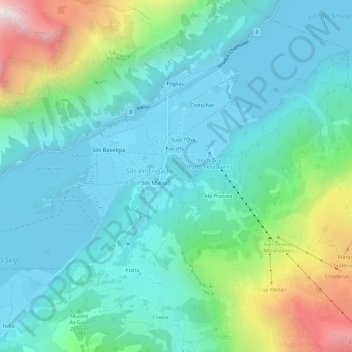
Name: Crastas topographic map, elevation, terrain.
Location: Crastas, Sils im Engadin, Maloja, Graubünden, 7514, Schweiz (46.40988 9.74741 46.44988 9.78741)
Average elevation: 6,759 ft
Minimum elevation: 5,863 ft
Maximum elevation: 9,767 ft