
Staphorst topographic map
Interactive map
Click on the map to display elevation.
About this map
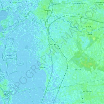
Name: Staphorst topographic map, elevation, terrain.
Location: Staphorst, Overijssel, Niederlande (52.58125 6.09592 52.69218 6.32931)
Average elevation: 7 ft
Minimum elevation: -16 ft
Maximum elevation: 26 ft
Other topographic maps
Click on a map to view its topography, its elevation and its terrain.
IJhorst
Niederlande > Overijssel > Staphorst
IJhorst, Staphorst, Overijssel, Niederlande
Average elevation: 13 ft