Geolocate

Longwy topographic map

Click on the map to display elevation.

About this map
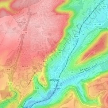
Name: Longwy topographic map, elevation, terrain.

Location: Longwy, Val-de-Briey, Meurthe-et-Moselle, Grand Est, Metropolitan France, 54400, France (49.50657 5.74539 49.53688 5.78840)

Average elevation: 1,089 ft

Minimum elevation: 820 ft

Maximum elevation: 1,306 ft

Other topographic maps

Click on a map to view its topography, its elevation and its terrain.

Lemont

France > Grand Est > Meurthe-et-Moselle > Cosnes-et-Romain

Average elevation: 1,191 ft

La Puce

France > Grand Est > Meurthe-et-Moselle > Boismont

Average elevation: 938 ft

Gear up for your next adventure:

🛰️Handheld GPS Units - Professional satellite navigators for precise backcountry mapping
🔭Compact Binoculars - HD vision for scouting terrain and identifying distant landmarks
📶Satellite Messenger - Communication device off‑grid
🪶Wildlife Field Guides - Learn animal tracking and species ID
📡Handheld GPS Device - Reliable handheld GPS for outdoor navigation

As an Amazon Associate, this site earns from qualifying purchases at no extra cost to you.