
Giurgiu topographic map
Interactive map
Click on the map to display elevation.
About this map
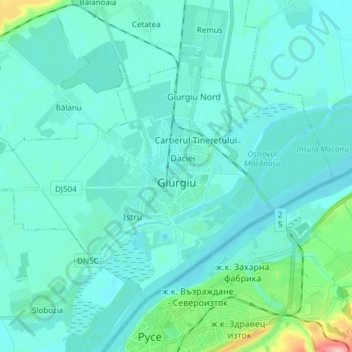
Name: Giurgiu topographic map, elevation, terrain.
Location: Giurgiu, Romania (43.85934 25.88112 43.93606 26.03282)
Average elevation: 92 ft
Minimum elevation: 43 ft
Maximum elevation: 449 ft
Other topographic maps
Click on a map to view its topography, its elevation and its terrain.