
Sarandí topographic map
Interactive map
Click on the map to display elevation.
About this map
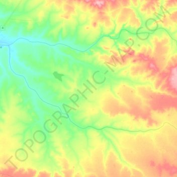
Name: Sarandí topographic map, elevation, terrain.
Location: Sarandí, Artigas, 55008, Uruguai (-30.87247 -56.75942 -30.78654 -56.55428)
Average elevation: 584 ft
Minimum elevation: 390 ft
Maximum elevation: 837 ft
Other topographic maps
Click on a map to view its topography, its elevation and its terrain.
Bella Unión
Uruguai > Artigas > Bella Unión
Bella Unión, Artigas, 55100, Uruguai
Average elevation: 151 ft