
Sakiet Sidi Youssef topographic map
Interactive map
Click on the map to display elevation.
About this map
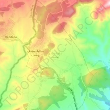
Name: Sakiet Sidi Youssef topographic map, elevation, terrain.
Average elevation: 2,484 ft
Minimum elevation: 1,824 ft
Maximum elevation: 3,281 ft
Other topographic maps
Click on a map to view its topography, its elevation and its terrain.
Safsaf
Safsaf, Délégation Kalaat Senan, Gouvernorat Le Kef, Tunisie
Average elevation: 2,917 ft
Et-Tabia
Et-Tabia, Délégation Sakiet Sidi Youssef, Gouvernorat Le Kef, Tunisie
Average elevation: 1,545 ft
Kalaat Senan
Kalaat Senan, Safsaf, Délégation Kalaat Senan, Gouvernorat Le Kef, 7130, Tunisie
Average elevation: 2,169 ft