
Wolkrange topographic map
Interactive map
Click on the map to display elevation.
About this map
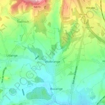
Name: Wolkrange topographic map, elevation, terrain.
Location: Wolkrange, Messancy, Arlon, Luxembourg, Wallonie, Belgique (49.61727 5.77507 49.66006 5.81917)
Average elevation: 1,096 ft
Minimum elevation: 938 ft
Maximum elevation: 1,450 ft