
Oum Ali topographic map
Interactive map
Click on the map to display elevation.
About this map
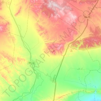
Name: Oum Ali topographic map, elevation, terrain.
Location: Oum Ali, daïra Oum Ali, Tébessa, Algérie (34.95375 8.21169 35.21727 8.39982)
Average elevation: 3,386 ft
Minimum elevation: 2,595 ft
Maximum elevation: 4,419 ft