
Sungai Muntoh topographic map
Interactive map
Click on the map to display elevation.
About this map
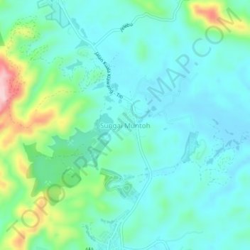
Name: Sungai Muntoh topographic map, elevation, terrain.
Location: Sungai Muntoh, Jelebu, Negeri Sembilan, Malaysia (2.99932 102.06091 3.03932 102.10091)
Average elevation: 528 ft
Minimum elevation: 361 ft
Maximum elevation: 1,112 ft