
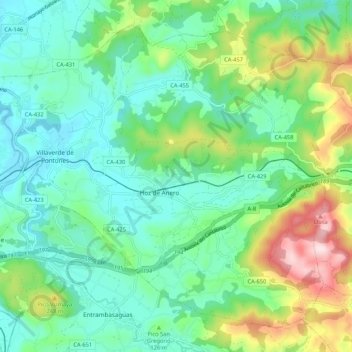
Ribamontán al Monte topographic map
Interactive map
Click on the map to display elevation.
About this map
Name: Ribamontán al Monte topographic map, elevation, terrain.
Location: Ribamontán al Monte, Trasmiera, Cantabria, Spain (43.37467 -3.71803 43.44143 -3.61150)
Average elevation: 358 ft
Minimum elevation: 13 ft
Maximum elevation: 1,270 ft
Other topographic maps
Click on a map to view its topography, its elevation and its terrain.
Pontones
Spain > Cantabria > Ribamontán al Monte > Villaverde de Pontones
Pontones, Villaverde de Pontones, Ribamontán al Monte, Cantabria, 39793, Spain
Average elevation: 203 ft