
Guaza topographic map
Interactive map
Click on the map to display elevation.
About this map
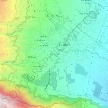
Name: Guaza topographic map, elevation, terrain.
Average elevation: 1,247 ft
Minimum elevation: 285 ft
Maximum elevation: 3,681 ft
Other topographic maps
Click on a map to view its topography, its elevation and its terrain.
La Corujera
La Corujera, Guaza, Güímar, Santa Cruz de Tenerife, Canary Islands, 38500, Spain
Average elevation: 1,690 ft
El Escobonal
El Escobonal, Güímar, Santa Cruz de Tenerife, Canary Islands, 38591, Spain
Average elevation: 1,827 ft