
Dhaulagiri II topographic map
Interactive map
Click on the map to display elevation.
About this map
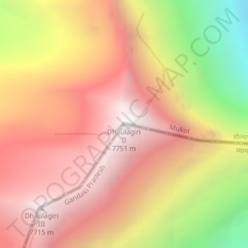
Name: Dhaulagiri II topographic map, elevation, terrain.
Average elevation: 22,664 ft
Minimum elevation: 18,274 ft
Maximum elevation: 25,410 ft
Other topographic maps
Click on a map to view its topography, its elevation and its terrain.
Dhaulagiri
Nepal > Región de desarrollo Oeste > Mudi
Dhaulagiri, Mudi, म्याग्दी (Myagdi), धौलागिरी अञ्चल, Región de desarrollo Oeste, Nepal
Average elevation: 24,019 ft