
Yucamani topographic map
Interactive map
Click on the map to display elevation.
About this map
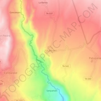
Name: Yucamani topographic map, elevation, terrain.
Location: Yucamani, Candarave, Tacna, Perú (-17.27939 -70.25377 -17.23939 -70.21377)
Average elevation: 11,119 ft
Minimum elevation: 9,921 ft
Maximum elevation: 11,755 ft