
Gagny topographic map
Interactive map
Click on the map to display elevation.
About this map
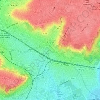
Name: Gagny topographic map, elevation, terrain.
Average elevation: 259 ft
Minimum elevation: 125 ft
Maximum elevation: 397 ft
Other topographic maps
Click on a map to view its topography, its elevation and its terrain.
Saint-Denis
France > Île-de-France > Seine-Saint-Denis > Saint-Denis
Saint-Denis, Seine-Saint-Denis, Île-de-France, France métropolitaine, 93200, France
Average elevation: 259 ft
Saint-Denis
France > Île-de-France > Seine-Saint-Denis
Saint-Denis, Seine-Saint-Denis, Île-de-France, France métropolitaine, France
Average elevation: 125 ft