Geolocate

Yankeetown topographic map

Click on the map to display elevation.

About this map

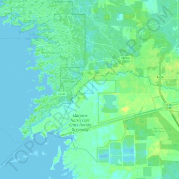
Name: Yankeetown topographic map, elevation, terrain.

Location: Yankeetown, Levy County, Florida, 34498, United States (28.99247 -82.81244 29.05373 -82.69127)

Average elevation: 20 ft

Minimum elevation: -7 ft

Maximum elevation: 69 ft

Levy County trails, hiking, mountain biking, running and outdoor activities

Other topographic maps

Click on a map to view its topography, its elevation and its terrain.

East Bronson

United States > Florida > Levy County

Average elevation: 89 ft

Raleigh

United States > Florida > Levy County

Average elevation: 75 ft

Morriston

United States > Florida > Levy County

Average elevation: 66 ft

Morriston

United States > Florida > Levy County

Average elevation: 66 ft

Crackertown

United States > Florida > Levy County > Inglis

Average elevation: 30 ft

Cedar Keys

United States > Florida > Levy County

Average elevation: 10 ft

East Bronson

United States > Florida > Levy County

Average elevation: 89 ft

Gear up for your next adventure:

🥾Hiking Shoes - Durable and comfortable shoes for trail hiking
🦶Hiking Gaiters - Keep debris and water out of your boots
🧭Pro Hiking Compasses - High-accuracy liquid-filled compasses for topographic orientation
🗻Climbing Gear Basics - Essential gear for beginner climbers
🌧️Backpack Rain Cover - Keep gear dry in wet weather

As an Amazon Associate, this site earns from qualifying purchases at no extra cost to you.