
Tsengel topographic map
Interactive map
Click on the map to display elevation.
About this map
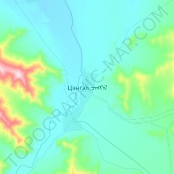
Name: Tsengel topographic map, elevation, terrain.
Location: Tsengel, Bayan-Ölgii, Mongolia (48.91227 89.10616 48.99227 89.18616)
Average elevation: 6,414 ft
Minimum elevation: 6,112 ft
Maximum elevation: 7,999 ft
Other topographic maps
Click on a map to view its topography, its elevation and its terrain.