
Zoomland topographic map
Interactive map
Click on the map to display elevation.
About this map
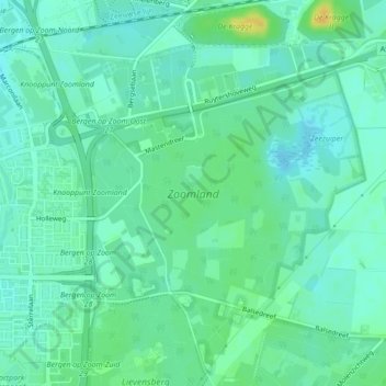
Name: Zoomland topographic map, elevation, terrain.
Location: Zoomland, Bergen op Zoom, Noord-Brabant, Nederland (51.48726 4.31682 51.50256 4.34499)
Average elevation: 33 ft
Minimum elevation: 7 ft
Maximum elevation: 92 ft
Other topographic maps
Click on a map to view its topography, its elevation and its terrain.
Halsteren
Nederland > Noord-Brabant > Bergen op Zoom
Halsteren, Bergen op Zoom, Noord-Brabant, Nederland
Average elevation: 10 ft
Lepelstraat
Nederland > Noord-Brabant > Bergen op Zoom
Lepelstraat, Bergen op Zoom, Noord-Brabant, Nederland
Average elevation: 7 ft