
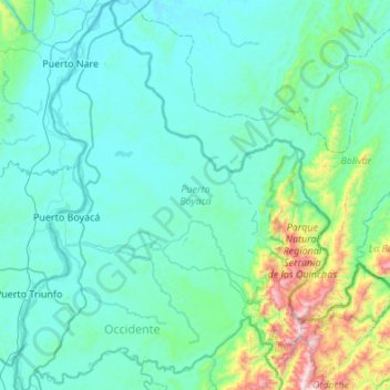
Puerto Boyacá topographic map
Interactive map
Click on the map to display elevation.
About this map
Name: Puerto Boyacá topographic map, elevation, terrain.
Location: Puerto Boyacá, Occidente, Boyacá, Colombia (5.73635 -74.65933 6.27563 -74.22278)
Average elevation: 846 ft
Minimum elevation: 371 ft
Maximum elevation: 4,206 ft