
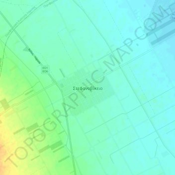
Stefanovikio topographic map
Interactive map
Click on the map to display elevation.
About this map
Name: Stefanovikio topographic map, elevation, terrain.
Average elevation: 174 ft
Minimum elevation: 148 ft
Maximum elevation: 240 ft
Other topographic maps
Click on a map to view its topography, its elevation and its terrain.
Ζαγορά
Greece > Thessaly and Central Greece > Regional Unit of Magnesia > Municipal Unit of Zagora
Ζαγορά, Municipal Unit of Zagora, Zagora - Mouresi Municipality, Regional Unit of Magnesia, Thessaly, Thessaly and Central Greece, 370 01, Greece
Average elevation: 1,716 ft
Milina
Greece > Thessaly and Central Greece > Regional Unit of Magnesia > Sipias Municipal Unit
Milina, Sipias Municipal Unit, South Pilio Municipality, Regional Unit of Magnesia, Thessaly, Thessaly and Central Greece, 370 13, Greece
Average elevation: 266 ft
Makrinitsa
Greece > Thessaly and Central Greece > Regional Unit of Magnesia > Volos Municipality
Makrinitsa, Volos Municipality, Regional Unit of Magnesia, Thessaly, Thessaly and Central Greece, 370 11, Greece
Average elevation: 2,175 ft
Volos
Greece > Thessaly and Central Greece > Regional Unit of Magnesia > Volos
Volos, Volos Municipality, Regional Unit of Magnesia, Thessaly, Thessaly and Central Greece, 38333, Greece
Average elevation: 817 ft
Volos Municipality
Greece > Thessaly and Central Greece > Regional Unit of Magnesia
Volos Municipality, Regional Unit of Magnesia, Thessaly, Thessaly and Central Greece, Greece
Average elevation: 748 ft
Almyros Municipality
Greece > Thessaly and Central Greece > Regional Unit of Magnesia
Almyros Municipality, Regional Unit of Magnesia, Thessaly, Thessaly and Central Greece, Greece
Average elevation: 1,096 ft
Agii Saranta
Greece > Thessaly and Central Greece > Regional Unit of Magnesia > Zagora > Agii Saranta
Agii Saranta, Zagora, Zagora - Mouresi Municipality, Regional Unit of Magnesia, Thessaly, Thessaly and Central Greece, 37001, Greece
Average elevation: 374 ft
Horefto
Greece > Thessaly and Central Greece > Regional Unit of Magnesia
Horefto, Regional Unit of Magnesia, Thessaly, Thessaly and Central Greece, 370 01, Greece
Average elevation: 413 ft