
Wisserhof topographic map
Interactive map
Click on the map to display elevation.
About this map
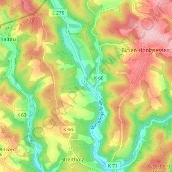
Name: Wisserhof topographic map, elevation, terrain.
Average elevation: 761 ft
Minimum elevation: 482 ft
Maximum elevation: 1,053 ft
Other topographic maps
Click on a map to view its topography, its elevation and its terrain.
Frankenthal
Deutschland > Rheinland-Pfalz > Landkreis Altenkirchen > Wissen
Frankenthal, Wissen, Landkreis Altenkirchen, Rheinland-Pfalz, 57537, Deutschland
Average elevation: 705 ft