
碌曲县 topographic map
Interactive map
Click on the map to display elevation.
About this map
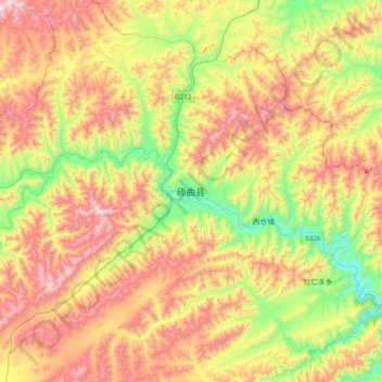
Name: 碌曲县 topographic map, elevation, terrain.
Location: 碌曲县, 玛艾镇, 碌曲县, 甘南藏族自治州, 甘肃省, 中国 (34.43277 102.32605 34.75277 102.64605)
Average elevation: 11,365 ft
Minimum elevation: 9,875 ft
Maximum elevation: 13,110 ft