
Araras topographic map
Click on the map to display elevation.
About this map
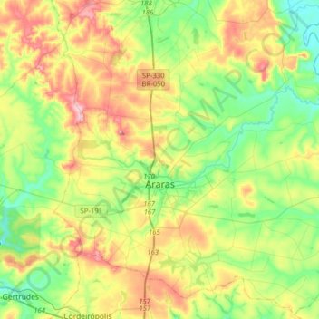
Name: Araras topographic map, elevation, terrain.
Average elevation: 2,159 ft
Minimum elevation: 1,844 ft
Maximum elevation: 2,697 ft
Other topographic maps
Click on a map to view its topography, its elevation and its terrain.
Kobayat Líbano
Brazil > São Paulo > Região Metropolitana de Piracicaba > Piracicaba
Average elevation: 1,709 ft
Nova Piracicaba
Brazil > São Paulo > Região Metropolitana de Piracicaba > Piracicaba
Average elevation: 1,617 ft
Mirante Rio Piracicaba
Brazil > São Paulo > Região Metropolitana de Piracicaba > Piracicaba
Average elevation: 1,657 ft