
Mont Sainte-Anne topographic map
Interactive map
Click on the map to display elevation.
About this map
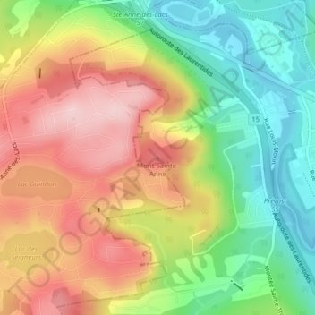
Name: Mont Sainte-Anne topographic map, elevation, terrain.
Average elevation: 850 ft
Minimum elevation: 505 ft
Maximum elevation: 1,224 ft
Other topographic maps
Click on a map to view its topography, its elevation and its terrain.
Shawbridge
Shawbridge, Prévost, La Rivière-du-Nord, Laurentides, Québec, J0R 1T0, Canada
Average elevation: 653 ft
Lac Saint-François
Lac Saint-François, Boulevard du Lac-Saint-François, Prévost, La Rivière-du-Nord, Laurentides, Québec, J7Y 3S3, Canada
Average elevation: 571 ft