
Jardim Cibele topographic map
Interactive map
Click on the map to display elevation.
About this map
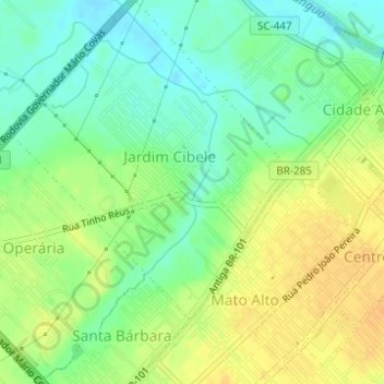
Name: Jardim Cibele topographic map, elevation, terrain.
Average elevation: 49 ft
Minimum elevation: -3 ft
Maximum elevation: 98 ft
Other topographic maps
Click on a map to view its topography, its elevation and its terrain.
Araranguá
Brasil > Santa Catarina > Araranguá > Araranguá
Araranguá, Região Geográfica Imediata de Araranguá, Região Geográfica Intermediária de Criciúma, Santa Catarina, Região Sul, 88900-003, Brasil
Average elevation: 36 ft