
Thank you for supporting this site ❤️
Make a donation
Make a donation
Gear up for your next adventure:
As an Amazon Associate, this site earns from qualifying purchases at no extra cost to you.
Moggio topographic map
Click on the map to display elevation.
Thank you for supporting this site ❤️
Make a donation
Make a donation
Gear up for your next adventure:
As an Amazon Associate, this site earns from qualifying purchases at no extra cost to you.
About this map
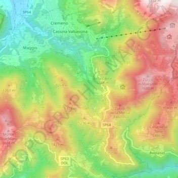
Name: Moggio topographic map, elevation, terrain.
Location: Moggio, Lecco, Lombardy, 23817, Italy (45.88363 9.47936 45.94237 9.54064)
Average elevation: 3,668 ft
Minimum elevation: 1,985 ft
Maximum elevation: 5,735 ft
Thank you for supporting this site ❤️
Make a donation
Make a donation
Gear up for your next adventure:
As an Amazon Associate, this site earns from qualifying purchases at no extra cost to you.