Pournari-I-Stausee topographic map
Interactive map
Click on the map to display elevation.
About this map
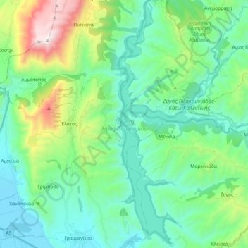
Name: Pournari-I-Stausee topographic map, elevation, terrain.
Average elevation: 1,109 ft
Minimum elevation: 10 ft
Maximum elevation: 4,780 ft

Click on the map to display elevation.
Name: Pournari-I-Stausee topographic map, elevation, terrain.
Average elevation: 1,109 ft
Minimum elevation: 10 ft
Maximum elevation: 4,780 ft