
Tosa Sucha topographic map
Interactive map
Click on the map to display elevation.
About this map
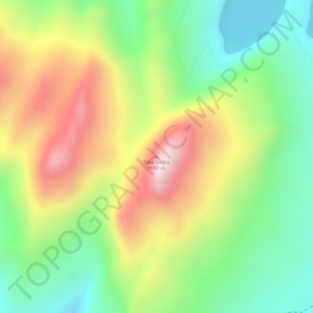
Name: Tosa Sucha topographic map, elevation, terrain.
Average elevation: 4,514 ft
Minimum elevation: 3,799 ft
Maximum elevation: 5,371 ft
Other topographic maps
Click on a map to view its topography, its elevation and its terrain.
Chamosee
Äthiopien > Südliche Nationen > አርባ ምንጭ / Arba Minch
Chamosee, Gamo Gofa, Südliche Nationen, 40, Äthiopien
Average elevation: 3,878 ft