
Manjil topographic map
Interactive map
Click on the map to display elevation.
About this map
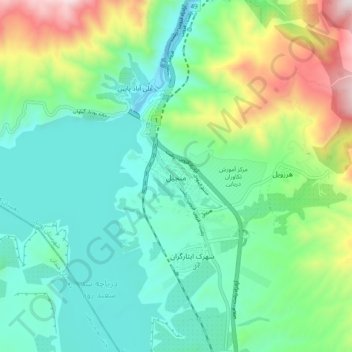
Name: Manjil topographic map, elevation, terrain.
Location: Manjil, کلشتر, بخش مرکزی, Rudbar County, Gilan Province, Iran (36.70485 49.36003 36.78485 49.44003)
Average elevation: 1,483 ft
Minimum elevation: 614 ft
Maximum elevation: 3,812 ft