
Coulonges-les-Sablons topographic map
Interactive map
Click on the map to display elevation.
About this map
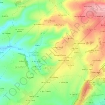
Name: Coulonges-les-Sablons topographic map, elevation, terrain.
Average elevation: 643 ft
Minimum elevation: 436 ft
Maximum elevation: 869 ft