
Chaupi topographic map
Interactive map
Click on the map to display elevation.
About this map
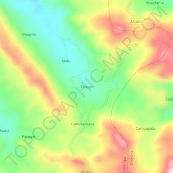
Name: Chaupi topographic map, elevation, terrain.
Location: Chaupi, Antabamba, Apurímac, Pérou (-14.51613 -72.68432 -14.47613 -72.64432)
Average elevation: 15,669 ft
Minimum elevation: 15,039 ft
Maximum elevation: 16,444 ft