
Fagge topographic map
Interactive map
Click on the map to display elevation.
About this map
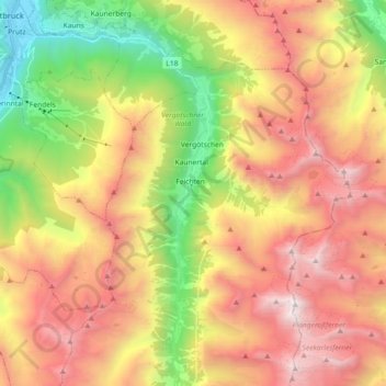
Name: Fagge topographic map, elevation, terrain.
Location: Fagge, Kaunertal, Landeck, Tyrol, 6524, Austria (46.96319 10.66393 47.08706 10.75462)
Average elevation: 7,156 ft
Minimum elevation: 2,828 ft
Maximum elevation: 11,447 ft
Other topographic maps
Click on a map to view its topography, its elevation and its terrain.
Ötztal Alps
Ötztal Alps, Kaunertal, Landeck, Tyrol, Austria
Average elevation: 6,883 ft