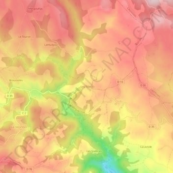
Les Tillets topographic map
Interactive map
Click on the map to display elevation.
About this map
Name: Les Tillets topographic map, elevation, terrain.
Average elevation: 1,850 ft
Minimum elevation: 1,204 ft
Maximum elevation: 2,178 ft

Click on the map to display elevation.
Name: Les Tillets topographic map, elevation, terrain.
Average elevation: 1,850 ft
Minimum elevation: 1,204 ft
Maximum elevation: 2,178 ft