
Arnoldstein topographic map
Interactive map
Click on the map to display elevation.
About this map
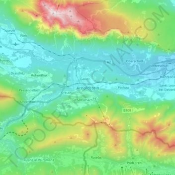
Name: Arnoldstein topographic map, elevation, terrain.
Location: Arnoldstein, Bezirk Villach-Land, Karinthië, Oostenrijk (46.50532 13.62190 46.59243 13.80863)
Average elevation: 3,068 ft
Minimum elevation: 1,611 ft
Maximum elevation: 7,080 ft