Pacococha topographic map
Interactive map
Click on the map to display elevation.
About this map
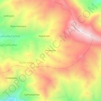
Name: Pacococha topographic map, elevation, terrain.
Average elevation: 12,507 ft
Minimum elevation: 10,853 ft
Maximum elevation: 13,776 ft

Click on the map to display elevation.
Name: Pacococha topographic map, elevation, terrain.
Average elevation: 12,507 ft
Minimum elevation: 10,853 ft
Maximum elevation: 13,776 ft