
永靖县 topographic map
Interactive map
Click on the map to display elevation.
About this map
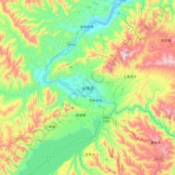
Name: 永靖县 topographic map, elevation, terrain.
Location: 永靖县, 临夏回族自治州, 甘肃省, 731600, 中国 (35.80124 103.12571 36.12124 103.44571)
Average elevation: 6,522 ft
Minimum elevation: 5,184 ft
Maximum elevation: 9,019 ft