
Zastron topographic map
Interactive map
Click on the map to display elevation.
About this map
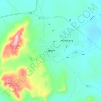
Name: Zastron topographic map, elevation, terrain.
Average elevation: 5,640 ft
Minimum elevation: 5,177 ft
Maximum elevation: 7,201 ft
Other topographic maps
Click on a map to view its topography, its elevation and its terrain.
Smithfield
South Africa > Free State > Xhariep District Municipality > Mohokare Local Municipality
Smithfield, Mohokare Local Municipality, Xhariep District Municipality, Free State, 9966, South Africa
Average elevation: 4,718 ft