
波密县 topographic map
Interactive map
Click on the map to display elevation.
About this map
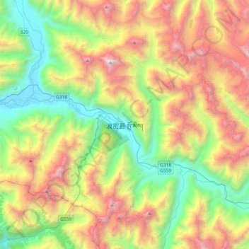
Name: 波密县 topographic map, elevation, terrain.
Location: 波密县, 扎木镇, 波密县, 林芝市, 西藏自治区, 中国 (29.70195 95.60706 30.02195 95.92706)
Average elevation: 13,117 ft
Minimum elevation: 8,753 ft
Maximum elevation: 19,925 ft
波密县地处念青唐古拉山东段和喜马拉雅山东端,北高南低,高山连绵,中部为帕龙藏布河谷和易贡藏布河谷,支流数十条,流域面积4549.6平方公里。境内有卡青、木如草复、罪玛、日母、关星、洛腮、公汤、曲玛尔矿勒、杂接着等十大名山。波密县境内最高海拔6648米,最低2001.4米,县政府驻地扎木镇海拔2720米。
Other topographic maps
Click on a map to view its topography, its elevation and its terrain.